
Blog > Buying Near Water in Eastern Ontario: What a Floodplain Designation Actually Changes
Buying Near Water in Eastern Ontario: What a Floodplain Designation Actually Changes
by
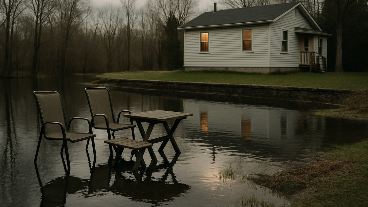
A floodplain or conservation authority designation does not stop you buying a property. It changes what you are allowed to do with it. Building, rebuilding, grading, filling and shoreline work inside a regulated area need a permit from the local conservation authority, and the authority can refuse.
Two checks belong in your condition period. Whether the property sits inside a regulated area, which the conservation authority will usually tell you within a day or two at no cost. And whether you can actually insure it for water, which needs a quote on the real address rather than a general question to a broker.
What “regulated” actually means
Since April 1, 2024, one provincial regulation covers this across Ontario: Ontario Regulation 41/24, Prohibited Activities, Exemptions and Permits, made under the Conservation Authorities Act. It replaced 36 separate conservation authority regulations with a single set of rules, and it narrowed what a permit condition can be about. Conditions now have to relate to natural hazard mitigation and public safety.
The Rideau Valley Conservation Authority describes the areas its regulation reaches as floodplains defined by the 1:100 year flood standard, wetlands, steep slopes in valleys and ravines, all watercourses including rivers, creeks, streams and drains, and all lakeshores.
The important part for a buyer: this attaches to the land, not to the building, and nothing in your agreement of purchase and sale changes it. A house can be perfectly sound, fully permitted and still sit inside a regulated area.
Where the line sits
Cataraqui Conservation, which covers the Brockville end of the corridor, publishes the screening distances it uses. They give you a sense of how far back from the water the regulation reaches:
| Feature on or near the property | Permit may be required within |
|---|---|
| A mapped floodplain | 15 metres of the floodplain |
| A waterbody with no floodplain mapping | 30 metres |
| The top of a valley slope | 30 metres |
| A provincially significant wetland | 30 metres |
| Other wetlands | 30 metres |
Those are Cataraqui’s published screening figures. Mapping and interpretation sit with the authority that covers the specific address, so treat the table as a reason to ask rather than an answer for your lot.
What triggers a permit
RVCA lists the activities its regulation captures on hazard land or near water:
- construction, reconstruction, erection or placing of a building or structure
- changes to a building that affect its use or potential use, increase its size, or add dwelling units
- site grading
- placing, dumping or removal of any material
- altering a watercourse channel
- changing or interfering with a wetland in any way
That list is broader than most people expect. Regrading a back yard, trucking in fill, replacing a retaining wall or finishing a basement into a second unit can all land on it.
The 2024 changes did add exemptions, including small seasonal docks and non-habitable structures outside wetlands and watercourses. If a dock is the whole reason you are asking, that may be good news, but confirm it for the specific property rather than assuming.
Timing matters if you plan to do work soon. RVCA reviews minor applications in 42 calendar days and major applications in 63 calendar days, excluding statutory holidays. That is the review window, not the pre-consultation and drawings that come before it.
Work done without a permit becomes your problem
This is the part worth asking the seller about directly. If a previous owner built, filled or graded inside the regulated area without a permit, the structure and the exposure come with the property.
The penalties introduced on April 1, 2024 are not nominal. RVCA sets them out as fines up to $50,000 per offence for an individual, plus $10,000 for each day an offence continues, and up to three months imprisonment. For a corporation, up to $1,000,000 plus $200,000 for each day.
In practice the more likely outcome is an order to remove or remediate. Either way you want to know before you waive, not after. Ask about permits for anything that looks added, the same way you would about a deck or a basement unit on any other purchase, and read it alongside your home inspection.
Who to call, between Ottawa and Brockville
Ottawa and the Rideau corridor. Rideau Valley Conservation Authority. It offers a free general property inquiry with a 24 hour response time, a paid property file search that takes about two weeks, and a Map A Property tool. Phone 613-692-3571 or 1-800-267-3504.
Brockville and the St. Lawrence. Cataraqui Conservation, whose jurisdiction runs from Greater Napanee in the west to Brockville in the east and up to Westport in the north, including the Thousand Islands. It has a Regulation Screening Map, and you can email development@crca.ca or call 613-546-4228 extension 221 with a civic address or tax roll number.
A name change is coming. Bill 97 received royal assent on April 24, 2026. Schedule 3 amalgamates 35 conservation authorities into eight new ones and continues the Lakehead authority under a new name, leaving nine regional authorities, with a transition date of February 1, 2027 or a later prescribed date. The new authorities take on the rights, obligations, assets and staff of the ones they replace, so a permit or an open file does not vanish. The letterhead and the phone number may.
Insurance is the other half of the question
Regulation decides what you can build. Insurance decides what happens when water actually arrives, and the two are not connected. A property can sit outside any regulated area and still be hard to insure, or sit inside one and be fine.
The market has improved a lot. The Insurance Bureau of Canada reported this past July that 94 per cent of residential properties in Canada can now access overland flood insurance, that more than 30 insurers offer some form of it, and that more than seven in ten homeowners buy it. Roughly 850,000 homes still cannot get it at all, down from about 1.5 million seven years earlier, and about 2 per cent of residential properties account for more than half of the country’s potential flood losses.
Do not plan around the federal backstop. Ottawa committed $450 million to a national flood insurance program aimed at the highest risk households. It was expected to launch in April 2026, it did not, and as of mid-2026 there was no confirmed delivery timeline.
So get a real quote during your conditions, on the actual address, and ask specifically what the overland water and sewer backup coverage includes and excludes. This is the same timing problem that shows up with older and rural properties, and it is worth reading how insurers handle older and rural homes alongside this. Lenders normally require property insurance in place to fund, so an insurance problem usually turns into a financing problem.
None of this makes waterfront a bad buy
I want to be clear about that. People buy along the St. Lawrence and the Rideau for good reasons and most of those properties are entirely straightforward. The Brockville waterfront is a real market with real value, not a hazard zone.
What changes is the homework. A regulated property rewards a buyer who asks early and punishes one who finds out after closing that the addition they planned needs a permit nobody will issue. If you are looking rural, this sits next to the same due diligence you would do on wells and septic systems.
Before you waive conditions
- Run the address through the conservation authority’s screening map, then confirm it with the authority using the civic address or roll number. Get the answer in writing.
- Ask the seller whether any structure, fill, grading or shoreline work has been done, and whether a conservation authority permit was issued for it.
- Get an insurance quote on the specific address, and ask what the water coverage excludes.
- If you intend to build, add, rebuild or regrade, ask the authority what a permit would involve before you commit, and allow for the review window.
- If there is a survey, find out how old it is and where the water was when it was drawn.
- Tell your lawyer what you found, before you waive rather than after.
A free property inquiry and one phone call to a broker is a small amount of work. It is the difference between buying a property knowing what it is, and finding out in the spring.
Looking at something near water between Ottawa and Brockville and not sure what the designation means for it?
Send me the address and what you have been told so far, and I will tell you what I would want checked on that particular property before you waive anything. Get in touch. No pressure either way.
Sources: Rideau Valley Conservation Authority, Section 28 FAQs; RVCA, About Section 28 permits; Cataraqui Conservation, Frequently Asked Questions; Aird & Berlis on the Conservation Authorities Act changes and O. Reg. 41/24; McMillan LLP, Ontario’s budget bill advances conservation authority consolidation; Legislative Assembly of Ontario, Bill 97; Insurance Business Canada on Insurance Bureau of Canada flood coverage data, July 2026.
This is general information about how conservation authority regulation and flood coverage work in Eastern Ontario, not legal or insurance advice. The authority that covers the address and the policy you are quoted are what govern your property.